University District, Columbus
University District covers 0.3 square miles of Columbus, and about 10,701 people live here. This page maps 67 parks and public places and 4 businesses inside its lines, most of them Food and Drink.

Living In University District
University District has about 10,701 people on 0.3 square miles, 30,750 per square mile, denser than Columbus as a whole (4,334).
100% of homes are rented, and the median rent is $634 a month.
People here skew younger, with a median age of 19 against 33 citywide.
56% of workers walk to work, against 3% across Columbus.
89% of homes have broadband internet.
Inside its lines: 23 parks, 22 landmarks and historic sites, 6 libraries, 4 museums and 2 places to eat.
People
Money And Work
Housing
Getting Around
Connected
US Census Bureau American Community Survey 2020 to 2024, added up from the census tracts in University District. Ranks count neighborhoods with 500 or more people.
Parks, Schools And Public Places In University District
Parks 23
- Bosque Garden
- College Green
- Commencement Grove
- Denney Courtyard
- Drackett Green
- Fisher Quad
- Garden of Constants
- Gateway Green
- Hale Green
- Hansford Quadrangle
- Knowlton Rooftop Garden
- Library Hill
11 more on the map below
Landmarks And Historic Sites 22
- Alpha Kappa Alpha
- Alpha Phi Alpha
- Bucket & Dipper Rock
- Delta Sigma Theta
- Five Brothers Rock
- Iota Phi Theta
- Kappa Alpha Psi
- Latitude Stone
- Old Ohio Union
- Omega Psi Phi
- Orton Hall
- Phi Beta Sigma
10 more on the map below
Libraries 6
 William Oxley Thompson Memorial Library1858 Neil Avenue Mall, Columbus, OH 43210
- 18th Avenue Library175 West Eighteenth Avenue, Columbus, 43210
- Architecture Library
- Fine Arts Library
- Geology Library155 South Oval Drive, Columbus, OH 43210
- Moritz Law Library
Museums 4
- Billy Ireland Cartoon Library & Museum1813 North High Street, Columbus, OH 43210
- Museum of Classical Archaeology
- Orton Geological Museum155 South Oval Drive, Columbus, OH 43210
- University Museum
Sports Fields 3
- 11th Avenue Volleyball Court
- Jesse Owens Recreation Center North2151 Neil Avenue, Columbus, OH 43210
- Jesse Owens Recreation Center South175 West Eleventh Avenue, Columbus, OH 43201
Theaters 3
- Browning Amphitheatre
- Mershon Auditorium1871 North High Street, Columbus, OH 43210
- NPHC Plaza
Arts Centers 1
 Wexner Center for the Arts1871 North High Street, Columbus, OH 43210
Colleges 1

Community Centers 1
 Ohio Union1739 North High Street, Columbus, OH 43210
Farmers Markets 1
Places Of Worship 1
- Saint Stephen's Episcopal Church
Post Offices 1
Places To Go In University District
The most reviewed spots inside these lines, with photos where they have one.
Parks, Beaches, Museums And Landmarks
Businesses In University District
Is yours missing or wrong? List or fix it free.
Food and Drink 2
 HangOverEasyBreakfast restaurant
- Adriatico's New York Style PizzaPizza restaurant
Lodging 1
Religious and Community 1
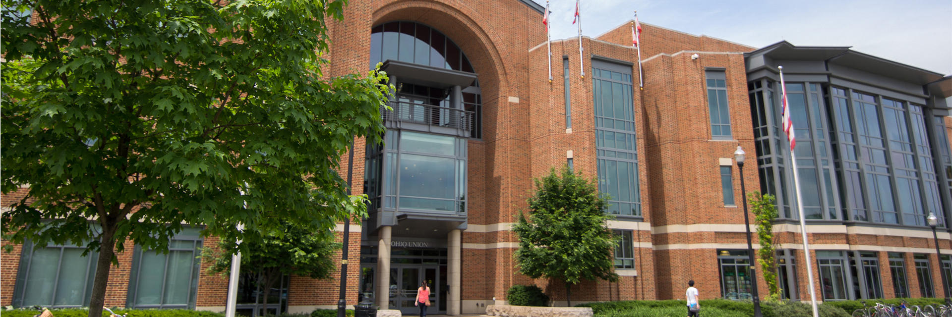 Ohio UnionStudent union
Own A Business In Columbus
List it free on your neighborhood page in about two minutes. Townstoop is built by Clickflame, building local business sites since 2004.
University District Questions
How many people live in University District
About 10,701, from the Census American Community Survey tracts inside the University District lines.
What parks are in University District
23 mapped, including Bosque Garden, College Green, Commencement Grove, Denney Courtyard.
What is the rent like in University District
The Census median gross rent is $634 a month, against $1,295 for all of Columbus.
Do people rent or own in University District
100% of homes are rented and 0% are owned, against 56% rented across Columbus.
How do people get to work from University District
The average commute is 13 minutes. 12% drive alone, 7% take transit, 56% walk and 22% work from home.
How old are the homes in University District
28% were built before 1960 and 15% in 2010 or later. 4% are single family homes.
Is University District a family neighborhood
5% of households have children and 2% of residents are under 18. 0% are 65 or older.
Sources, Census figures from the US Census Bureau American Community Survey five year estimates, parks, schools and public places from OpenStreetMap contributors (ODbL). How we build these pages.